
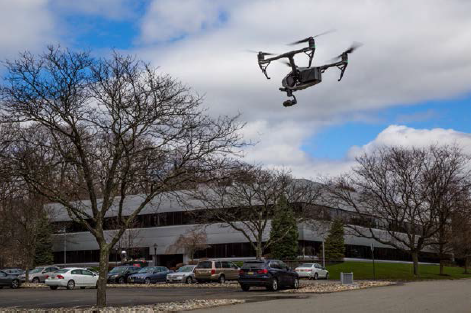
Let’s explore using drones in commercial real estate applications. Drones have been around since the early 1900s when they were known as radio-controlled airplanes and during WWII were used for aerial photography. Through the years, that definition has changed numerous times, but make no mistake, today’s drones are no comparison to those early models. Technologically speaking, the correct terminology is Unmanned Aerial Vehicles, or UAVs. UAVs fall into two categories—commercial and recreational. With the increased development of affordable technology and availability—hobbyists have gone into a frenzy for sport and entertainment drones. However, when referring to commercial grade UAVs you’re looking at an entirely different animal and there are a lot of things to take into consideration before launching a geospatial eye in the sky. For starters, commercial UAVs must adhere to strict Federal Aviation Administration (FAA) guidelines and restrictions. They also need certified FAA Part 107 licensed pilots, trained ground crew, and an insurance policy in order to operate them.
Using Professional Drones for Commercial Real Estate
 Professional UAVs (drones) combined with a certified flight team to operate it is referred to as an Unmanned Aerial System (UAS). Commercial UAS has a multitude of functions depending upon what your use for them is. When outfitted with a Light Detection and Ranging (LiDAR) survey unit, a UAS can collect highly accurate 3D survey data for large land parcels, including mapping for transportation planning, traffic monitoring and assessments, utility mapping and asset identification and inventory, in hours rather than through conventional ground methods that could take days.
Some larger tasks, such as surveying and mapping large acreages or roadways may be performed in a few hours/days’ time as opposed to using only conventional boots on-the-ground work flow processes that, when used alone, uses more staff and could turn into weeks. The secret to large parcel survey is that the UAS can be set to scan a predetermined flight path and fly autonomously. Because the UAS is operated from a remote station on the ground, this method takes people out of the equation, hence, out of harm’s way. Safety is always
a benefit, and when it takes less time it costs less money.
LiDAR is so versatile it can integrate highly accurate survey data collected from multiple sources on the ground (static), from a vehicle (mobile) and from the air (UAV) to produce a unified and measurable client deliverable.
Using Drones for Site Survey
An example of why this is advantageous would be if you bought a large property with an existing building on it with intent to completely redevelop the parcel that included renovating and updating the building. The first thing you’d likely do is have topographic and boundary surveys performed. While static survey can be performed from the ground, UAS can be used to map existing assets, and collect measurement data from the building top and exterior. When using cameras and videos, hi-rise inspections can be made to pinpoint areas in need of attention so the overall condition of the building can be assessed, enabling stakeholders to make timely decisions. Since operating UAS remotely from the ground, it eliminates the need to employ someone to physically navigate scaffolding or ladders which again equates to better safety.
As for the existing building, while you may be able to put a time stamp on the year it was built, getting your hands on the original drawings, or the often elusive or non-existent as-built drawings, may be much more difficult or impossible to obtain. Using a combination of UAS and LiDAR can help you quickly and accurately reproduce the existing building interior and exterior layouts and condition. It is also an asset in adaptive reuse projects, for example in helping to match floor and ceiling heights between old and new structures. Another example is in historical building restorations as laser scanning can be performed to replicate significant missing pieces of a building’s exterior.
UAS can continue to be employed throughout the entire construction process for help in determining site drainage and earthmoving requirements, volumetrics (stockpile measurement), material and quantity monitoring, provide reports through site surveillance and monitoring of the overall construction progress.
Using Drones for Site Investigation
UAS can also be used for initial site investigation. Due to its relatively small size and increased maneuverability,
a UAS can easily access places that conventional airplanes and helicopters cannot. One of the biggest advantages of using UAS as opposed to former means of aerial photography, is that UAS is static in the sky.
When outfitted with a high resolution scanner, a UAS can hover-in-place to provide measurement or video inspection exploring places that may otherwise be limited or hazardous for field crews to access like between high tension wires, telecom towers, windmill tower blades or building tops. Pretty much, UAS is a tool to get a sensor, camera or LiDAR in the right location. For environmental sites, when fitted with various sensors, a UAS
can provide data that detects light, energy, heat, toxins—even vegetation health. UAS can be sent ahead of the investigative team into a variety of settings, such as a mine, with sensors that detect toxic leaks that can protect
the team. Today’s UAV (drones) technology has so many potential uses that if a sensor for detecting something hasn’t been released to the public yet, it is probably already in development.
Using Drones for Site Monitoring
UAS is fast becoming an additional service offered by construction equipment providers that rent heavy machinery such as lifts, bulldozers, and scaffolding for large construction projects. Having a UAS can also help to safely monitor and assess situational conditions caused by the environment including flooding, sink holes, landslides, earthquakes, hurricanes and tornadoes that may affect your properties.
But the question remains; is it cost effective and the best use of technology to invest in my own UAS? That answer is up to the individual. Either way, it is important to reach out to a professional UAS service provider who
can steer you in the right direction as to developing your own in-house service or who can perform these tasks for you.
Using a mix of conventional ground survey and geospatial methods is still appropriate, promotes safety, saves time and is cost effective translating into a better bottom line for your project. Integrating a professional grade UAS into your work flow process can be an extremely versatile tool in assisting commercial developers.
Technology is creating a whole new era in how we do business and it’s not likely to stop here!

Rhett N. Chiliberti, P.E.
Geographic Discipline Leader
Maser Consulting P.A.
1500 JFk Blvd – Suite 222
Philadelphia, PA 19102
P: 215.861.9021 ext: 5101
C: 215.915.0534
www.maserconsulting.com